Geolocate

Thomas Terrace topographic map

Click on the map to display elevation.

About this map
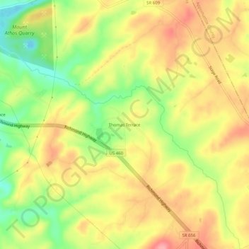
Name: Thomas Terrace topographic map, elevation, terrain.

Location: Thomas Terrace, Campbell County, Virginia, United States (37.35403 -79.03391 37.39403 -78.99391)

Average elevation: 226 m

Minimum elevation: 167 m

Maximum elevation: 274 m

Gear up for your next adventure:

🧢Outdoor Cap - Protective cap for sun and rain during hikes
🥤Collapsible Travel Cup - Saves space and weight in your mess kit
🕶️Polarized Sunglasses - Reduces glare from snow and water at high elevations
🚑Survival Whistle - Signal for help across long distances in mountains
🧊Insulated Water Bottle - Keeps drinks cold in summer and prevents freezing in winter

As an Amazon Associate, this site earns from qualifying purchases at no extra cost to you.