Arizona topographic maps
Click on a map to view its topography, its elevation and its terrain.
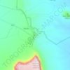
Monument Valley
United States > Arizona > Navajo County
The area is part of the Colorado Plateau. The elevation of the valley floor ranges from 5,000 to 6,000 feet (1,500 to 1,800 m) above sea level. The floor is largely siltstone of the Cutler Group, or sand derived from it, deposited by the meandering rivers that carved the valley. The valley's vivid red color…
Average elevation: 1,675 m
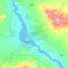

Williams
United States > Arizona > Coconino County
Williams occupies a high, forested setting in northern Arizona, in the heart of the Kaibab National Forest at about 6,770 feet (2,063 m) above sea level, where broad plateau surfaces, shallow drainage corridors, and low volcanic hills give the town a gently undulating upland character. Its most prominent…
Average elevation: 2,131 m


Yavapai County
The county's topography makes a dramatic transition from the lower Sonoran Desert to the south to the heights of the Coconino Plateau to the north, and the Mogollon Rim to the east. The highest point above sea level (MSL) in Yavapai County is Mount Union at an elevation of 7,979 ft (2,432 m) and the lowest is…
Average elevation: 1,433 m


Heaton
United States > Arizona > Pinal County > Maricopa
Heaton is a populated place situated in Pinal County, Arizona, United States. Originally called Maricopa Station, it served as a stop on the railroad line, where passengers transferred to stagecoach. The post office at this location was simply named Maricopa. During a land boom in the late 1880s, it was…
Average elevation: 367 m


Prescott
United States > Arizona > Yavapai County
Prescott is in the Bradshaw Mountains of central Arizona, at an elevation of 5,400 feet (1,600 m). The city has a Mediterranean climate (Köppen Csa) bordering on a Humid subtropical climate (Köppen Cfa); however, unlike most other locations in this climate class, there is a pronounced summer wet season due…
Average elevation: 1,674 m

Three Sisters
United States > Arizona > Navajo County
Monument Valley is part of the Colorado Plateau. The elevation of the valley floor ranges from 5,000 to 6,000 feet (1,500 to 1,800 m) above sea level. The floor is largely siltstone of the Cutler Group, or sand derived from it, deposited by the meandering rivers that carved the valley. The valley's vivid red…
Average elevation: 1,667 m