Geolocate

Indiana topographic maps

Click on a map to view its topography, its elevation and its terrain.

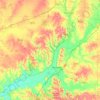
Fort Wayne

United States > Indiana > Allen County

Pioneer newspaperman George W. Wood was elected the city's first mayor. Fort Wayne's "Summit City" nickname dates from this period, referring to the city's position at the highest elevation along the canal's route. As influential as the canal was to the city's earliest development, it quickly became obsolete…

Average elevation: 246 m
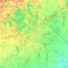
White County

United States > Indiana

Average elevation: 210 m

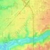
Morgan County

United States > Indiana

Morgan County is where the glaciers stopped their southward advance during the last ice age. As a result, the area has both flat areas and rolling hills, with the most diverse soil of any county in the United States. The extensive woodlands of the eighteenth century have been cleared on the county's flat…

Average elevation: 224 m
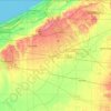
Santa Claus

United States > Indiana > Spencer County

Average elevation: 144 m

Mansfield

United States > Indiana > Parke County

Average elevation: 196 m

La Porte

United States > Indiana > LaPorte County

Average elevation: 246 m

Deer Creek

United States > Indiana > Carroll County > Delphi

Average elevation: 188 m

Sullivan

United States > Indiana > Sullivan County

Average elevation: 155 m

Ambia

United States > Indiana > Benton County

Average elevation: 224 m
Klondyke

United States > Indiana > Parke County

Average elevation: 168 m

Allen County

United States > Indiana

Average elevation: 246 m

Huntington County

United States > Indiana

Average elevation: 251 m

LaPorte County

United States > Indiana

Average elevation: 219 m

Madison County

United States > Indiana

Average elevation: 270 m

Perth

United States > Indiana > Clay County

Average elevation: 193 m

Warrick County

United States > Indiana

Average elevation: 130 m

Fish Creek

United States > Indiana > LaPorte County > Fish Lake

Average elevation: 217 m

Byron

United States > Indiana > Parke County

Average elevation: 226 m

Carmel

United States > Indiana > Hamilton County

Average elevation: 254 m

Pleasant

United States > Indiana > Switzerland County

Average elevation: 282 m

Groomsville

United States > Indiana > Tipton County > Groomsville

Average elevation: 275 m

Peru

United States > Indiana > Miami County

Average elevation: 216 m

About this place

 •  •  •  •  •  •  •  •  •  •  •  •  •

Gear up for your next adventure:

🥾Lightweight Hiking Boots - Boots for comfort and mobility on long hikes
🍽️Titanium Camping Spork - Ultralight and indestructible eating utensil
🥾Hiking Shorts - Breathable shorts suitable for summer hikes
💧Collapsible Water Bottle - Space-saving water bottle for outdoor activities
⛺Tent Footprint - Protect tent floor and increase durability

As an Amazon Associate, this site earns from qualifying purchases at no extra cost to you.