Geolocate

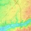
Huntington County topographic map

Click on the map to display elevation.

About this map

Name: Huntington County topographic map, elevation, terrain.

Location: Huntington County, Indiana, United States (40.65307 -85.64373 41.00612 -85.33417)

Average elevation: 251 m

Minimum elevation: 205 m

Maximum elevation: 284 m

Other topographic maps

Click on a map to view its topography, its elevation and its terrain.

Deer Creek

United States > Indiana > Carroll County > Delphi

Average elevation: 188 m

Mansfield

United States > Indiana > Parke County

Average elevation: 196 m

Klondyke

United States > Indiana > Parke County

Average elevation: 168 m

Perth

United States > Indiana > Clay County

Average elevation: 193 m

Pleasant

United States > Indiana > Switzerland County

Average elevation: 282 m

Byron

United States > Indiana > Parke County

Average elevation: 226 m

Groomsville

United States > Indiana > Tipton County > Groomsville

Average elevation: 275 m

Gear up for your next adventure:

👟Sport Hiking Sandals - Breathable footwear for water crossings and camp rest
🥫Freeze-Dried Meals - Lightweight, high-calorie nutrition for multi-day treks
👟Leg Gaiters - Keep debris, mud, and snow out of your boots
🥾Trekking Boots - Durable boots for long-distance trekking
🧴Sunscreen SPF - Broad-spectrum sunscreen for outdoor activities

As an Amazon Associate, this site earns from qualifying purchases at no extra cost to you.