Geolocate

Carmel topographic map

Click on the map to display elevation.

About this map
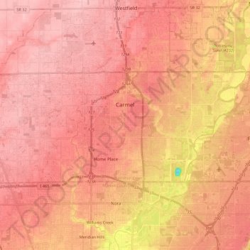
Name: Carmel topographic map, elevation, terrain.

Location: Carmel, Hamilton County, Indiana, United States (39.92604 -86.24107 40.00312 -86.02352)

Average elevation: 254 m

Minimum elevation: 153 m

Maximum elevation: 288 m

Gear up for your next adventure:

🛌Insulated Sleeping Pad - Critical thermal barrier between you and the cold ground
🏕️Camping Hammock - Integrated protection for sleeping between trees
🚲Bike Repair Kit - Essential tools for on-trail mechanical issues
🎒Hiking Backpack - Lightweight and ergonomic backpacks for day hikes or multi-day treks
🥾Trail Hiking Shoes - Durable shoes designed for rugged trails

As an Amazon Associate, this site earns from qualifying purchases at no extra cost to you.