
Yanai topographic map
Interactive map
Click on the map to display elevation.
About this map
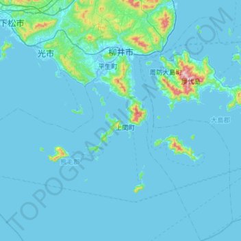
Name: Yanai topographic map, elevation, terrain.
Location: Yanai, Préfecture de Yamaguchi, Japon (33.63030 132.05723 34.05291 132.33736)
Average elevation: 32 m
Minimum elevation: -4 m
Maximum elevation: 653 m
Other topographic maps
Click on a map to view its topography, its elevation and its terrain.