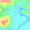
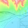
Railroad Valley topographic map
Click on the map to display elevation.
About this map

Name: Railroad Valley topographic map, elevation, terrain.
Location: Railroad Valley, Nevada, United States (37.73209 -116.24188 39.20702 -115.45258)
Average elevation: 1,912 m
Minimum elevation: 1,325 m
Maximum elevation: 3,416 m
Other topographic maps
Click on a map to view its topography, its elevation and its terrain.
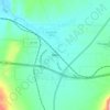
Wells
United States > Nevada > Elko County
According to the United States Census Bureau, the city has a total area of 6.9 square miles (18 km2), all land, at an elevation of 5,630 feet (1,720 m).
Average elevation: 1,744 m