Geolocate

Holborn topographic map

Click on the map to display elevation.

About this map

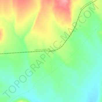
Name: Holborn topographic map, elevation, terrain.

Location: Holborn, Elko County, Nevada, United States (41.15437 -114.72893 41.19437 -114.68893)

Average elevation: 1,855 m

Minimum elevation: 1,810 m

Maximum elevation: 1,926 m

Gear up for your next adventure:

🔥Camping Stove - Portable stoves to cook outdoors with ease
🧥Thermal Layer - Insulating layer for cold outdoor conditions
🥾Hiking Shoes - Durable and comfortable shoes for trail hiking
🥾Lightweight Hiking Boots - Boots for comfort and mobility on long hikes
🥾Hiking Shorts - Breathable shorts suitable for summer hikes

As an Amazon Associate, this site earns from qualifying purchases at no extra cost to you.