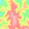
Dodoma Region topographic map
Click on the map to display elevation.
Dodoma Region
Due to irregular and low rainfall, the Dodoma region is primarily semi-arid. Rainfall in the region usually falls between November/December and April/May in a single rainy season. Often, storms bring strong rains that cause flash floods. The annual total precipitation ranges from 500 to 800 mm. Although the temperature in the area varies depending on elevation, it typically ranges from around 15 °C in July to 30 °C in October. There can be significant temperature changes between day and night, with afternoons reaching temperatures of up to 35 °C and nights reaching temperatures of around 10 °C.
About this map

Name: Dodoma Region topographic map, elevation, terrain.
Location: Dodoma Region, Central Zone, Tanzania (-7.37936 35.05352 -4.31508 36.96481)
Average elevation: 1,159 m
Minimum elevation: 380 m
Maximum elevation: 3,212 m
Other topographic maps
Click on a map to view its topography, its elevation and its terrain.


Uhuru Peak
Kilimanjaro is the fourth most topographically prominent peak on Earth. It is part of Kilimanjaro National Park and is a major hiking and climbing destination. Because of its shrinking glaciers and ice fields, which are projected to disappear between 2025 and 2035, it has been the subject of many scientific…
Average elevation: 5,494 m


Arusha
Despite its proximity to the equator, Arusha's elevation of 1,400 metres (4,600 ft) on the southern slopes of Mount Meru keeps temperatures relatively low and alleviates humidity. Cool dry air is prevalent for much of the year. The temperature typically ranges between 10 and 30 °C (50 and 86 °F) with an…
Average elevation: 1,572 m