Geolocate

Mwasonga topographic map

Click on the map to display elevation.

About this map

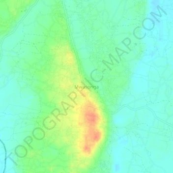
Name: Mwasonga topographic map, elevation, terrain.

Location: Mwasonga, Dar es-Salaam, Coastal Zone, Tanzania (-7.01626 39.40487 -6.97626 39.44487)

Average elevation: 51 m

Minimum elevation: 37 m

Maximum elevation: 81 m

Other topographic maps

Click on a map to view its topography, its elevation and its terrain.

Ubungo

Tanzania > Dar es-Salaam

Average elevation: 62 m

Gear up for your next adventure:

💡LED Headlamp - Hands-free illumination for night hiking and camping
🥾Trail Hiking Socks - Comfortable socks to prevent blisters and fatigue
🔋Lithium AA Batteries - Long-lasting power that performs in extreme cold
🧢Sun Protection Cap - Breathable cap to protect from sun exposure
🥾Waterproof Hiking Boots - Boots keeping your feet dry in wet conditions

As an Amazon Associate, this site earns from qualifying purchases at no extra cost to you.