Geolocate

Nyangoto topographic map

Click on the map to display elevation.

About this map

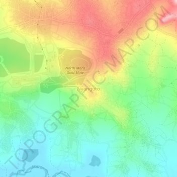
Name: Nyangoto topographic map, elevation, terrain.

Location: Nyangoto, Tarime, Mara Region, Lake Zone, Tanzania (-1.50030 34.49967 -1.46030 34.53967)

Average elevation: 1,247 m

Minimum elevation: 1,171 m

Maximum elevation: 1,355 m

Gear up for your next adventure:

🔥Camping Stove - Portable stoves to cook outdoors with ease
🧳Compression Sacks - Maximize space in your backpack by shrinking gear
🧥Thermal Fleece Jacket - Versatile insulation for changing mountain temperatures
💧Collapsible Water Bottle - Space-saving water bottle for outdoor activities
🦯Trekking Poles - Reduced impact on joints for steep topographic climbs

As an Amazon Associate, this site earns from qualifying purchases at no extra cost to you.