Geolocate

Malampaka topographic map

Click on the map to display elevation.

About this map

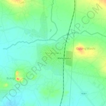
Name: Malampaka topographic map, elevation, terrain.

Location: Malampaka, Maswa, Simiyu, Lake Zone, Tanzania (-3.15772 33.50408 -3.11772 33.54408)

Average elevation: 1,242 m

Minimum elevation: 1,227 m

Maximum elevation: 1,274 m

Gear up for your next adventure:

🦶Anti-Blister Balm - Prevents friction and hotspots during long ascents
🧰Survival Kit - Essential gear for emergencies in the wilderness
🥾Mountain Trail Shoes - High-traction shoes for mountain trails
🛶Canoe Life Vest - Safety vest for water sports
🧣Merino Neck Gaiter - Protects against wind, sun, and cold at high altitudes

As an Amazon Associate, this site earns from qualifying purchases at no extra cost to you.