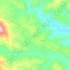
Mtwara Region topographic map
Click on the map to display elevation.
Mtwara Region
Mtwara is both the most eastern and southern region in the country. The region is located between 10 and 11 degrees south of the Equator. Mtwara is the third smallest region after Dar es Salaam Region and Kilimanjaro Region at 16,710 km2 (6,450 sq mi). The area occupied 1.9% of the country. In comparison, Mtwara is slightly smaller than the African nation of Eswatini at 17,230 square kilometers. Mtwara's central area is of high elevation, home to the Makonde plateau with Mtwara Region's highest point being Masasi peak at 837 meters above sea level. The largest and longest river in Mtwara Region is the Ruvuma River which is fed by the Mbangala River within the region as one of Ruvuma's many tributaries.
About this map

Name: Mtwara Region topographic map, elevation, terrain.
Location: Mtwara Region, Coastal Zone, Tanzania (-11.41941 37.99991 -10.12809 40.44539)
Average elevation: 298 m
Minimum elevation: -2 m
Maximum elevation: 997 m
Other topographic maps
Click on a map to view its topography, its elevation and its terrain.


Uhuru Peak
Kilimanjaro is the fourth most topographically prominent peak on Earth. It is part of Kilimanjaro National Park and is a major hiking and climbing destination. Because of its shrinking glaciers and ice fields, which are projected to disappear between 2025 and 2035, it has been the subject of many scientific…
Average elevation: 5,494 m


Arusha
Despite its proximity to the equator, Arusha's elevation of 1,400 metres (4,600 ft) on the southern slopes of Mount Meru keeps temperatures relatively low and alleviates humidity. Cool dry air is prevalent for much of the year. The temperature typically ranges between 10 and 30 °C (50 and 86 °F) with an…
Average elevation: 1,572 m