Nova Scotia topographic maps
Click on a map to view its topography, its elevation and its terrain.
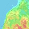
Annapolis Valley
Canada > Nova Scotia > Municipality of the County of Kings > Auburn
Average elevation: 77 m
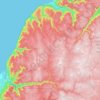
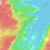
Cape Breton Highlands National Park
Canada > Nova Scotia > Municipality of the County of Inverness
Average elevation: 330 m

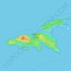

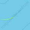
Sable Island
Canada > Nova Scotia > Halifax County > Sable Island
Sable Island is a narrow, crescent-shaped sandbar with a surface area estimated around 34 km2 (13 sq mi). Despite being approximately 43.15 km (26.81 mi) long, it is only 1.21 km (0.75 mi) across at its widest point. The maximum elevation is about 30 m (98 ft). The long crescent-shaped island rises gently from…
Average elevation: 0 m


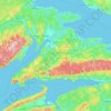











Cranberry Lake
Canada > Nova Scotia > Cape Breton Regional Municipality > Enon
Average elevation: 103 m
Victoria Bridge
Canada > Nova Scotia > Cape Breton Regional Municipality > Upper Grand Mira
Average elevation: 17 m
Salmon River Road
Canada > Nova Scotia > Cape Breton Regional Municipality > Grand Mira North
Average elevation: 18 m


Meat Cove
Canada > Nova Scotia > Municipality of the County of Inverness > Meat Cove
Average elevation: 117 m
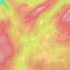
Roundhill Lakes
Canada > Nova Scotia > Municipality of Victoria County > Cape Breton Highlands National Park
Average elevation: 427 m


White Hill
Canada > Nova Scotia > Cape Breton Highlands National Park > Cape Breton Highlands National Park
White Hill is a peak in the Cape Breton Highlands and is the highest elevation point in the province of Nova Scotia, Canada.
Average elevation: 488 m

Hawleys Hill
Canada > Nova Scotia > Municipality of the County of Inverness > Mabou
Average elevation: 90 m

The Lookoff
Canada > Nova Scotia > Municipality of Victoria County > Forks Baddeck
Average elevation: 301 m

Upper Glencoe
Canada > Nova Scotia > Municipality of the County of Inverness > Glencoe
Average elevation: 181 m


Ponhook Cove
Canada > Nova Scotia > Halifax County > Head of St. Margarets Bay
Average elevation: 130 m

Westchester Valley
Canada > Nova Scotia > Municipality of the County of Cumberland
Average elevation: 194 m

River Philip Centre
Canada > Nova Scotia > Municipality of the County of Cumberland
Average elevation: 85 m
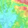
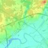
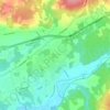
Staples Brook
Canada > Nova Scotia > Municipality of Colchester > Staples Brook
Average elevation: 69 m

Chignecto Isthmus
Canada > Nova Scotia > Municipality of the County of Cumberland > Fort Lawrence
Average elevation: 14 m

Canaan Mountains
Canada > Nova Scotia > Municipality of the County of Cumberland > New Canaan
Average elevation: 97 m

Two Rivers
Canada > Nova Scotia > Municipality of the County of Cumberland > Joggins
Average elevation: 52 m