Geolocate

Potato Island topographic map

Click on the map to display elevation.

About this map

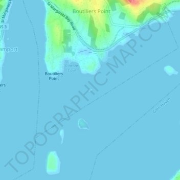
Name: Potato Island topographic map, elevation, terrain.

Location: Potato Island, Boutiliers Point, Nova Scotia, Canada (44.65146 -63.95063 44.65185 -63.94990)

Average elevation: 4 m

Minimum elevation: -1 m

Maximum elevation: 69 m

Nova Scotia trails, hiking, mountain biking, running and outdoor activities

Gear up for your next adventure:

🚲MTB Frame Bag - Carry tools and maps directly on your bicycle frame
👖Convertible Hiking Pants - Zip-off legs to adapt to changing weather conditions
🥾Hiking Shoes - Durable and comfortable shoes for trail hiking
🥾Trekking Poles - Adjustable trekking poles to reduce knee stress and improve stability
🛶Waterproof Dry Bags - Keep electronics and clothes dry during river crossings

As an Amazon Associate, this site earns from qualifying purchases at no extra cost to you.