
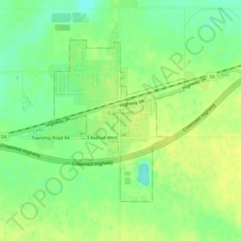
Village of Barnwell topographic map
Interactive map
Click on the map to display elevation.
Village of Barnwell topographic map, elevation, terrain
About this map
Name: Village of Barnwell topographic map, elevation, terrain.
Location: Village of Barnwell, Division No. 2, Alberta, Canada (49.74965 -112.27383 49.76776 -112.25121)
Average elevation: 832 m
Minimum elevation: 821 m
Maximum elevation: 839 m
Other topographic maps
Click on a map to view its topography, its elevation and its terrain.
Dinosaur Provincial Park
Canada > Alberta > Division No. 2
The park is situated in the valley of the Red Deer River, which is noted for its striking badland topography. The park is well known for being one of the richest dinosaur fossil locales in the world. Fifty-eight dinosaur species have been discovered at the park and more than 500 specimens have been removed and…
Average elevation: 712 m