
Thank you for supporting this site ❤️
Make a donation
Make a donation
Gear up for your next adventure:
As an Amazon Associate, this site earns from qualifying purchases at no extra cost to you.
Vauxhall topographic map
Click on the map to display elevation.
Thank you for supporting this site ❤️
Make a donation
Make a donation
Gear up for your next adventure:
As an Amazon Associate, this site earns from qualifying purchases at no extra cost to you.
About this map
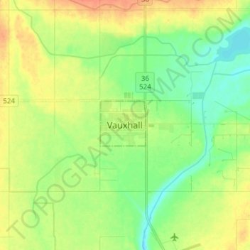
Name: Vauxhall topographic map, elevation, terrain.
Location: Vauxhall, Town of Vauxhall, Alberta, T0K 2K0, Canada (50.02918 -112.14769 50.10918 -112.06769)
Average elevation: 781 m
Minimum elevation: 765 m
Maximum elevation: 801 m
Town of Vauxhall trails, hiking, mountain biking, running and outdoor activities
Thank you for supporting this site ❤️
Make a donation
Make a donation
Gear up for your next adventure:
As an Amazon Associate, this site earns from qualifying purchases at no extra cost to you.