
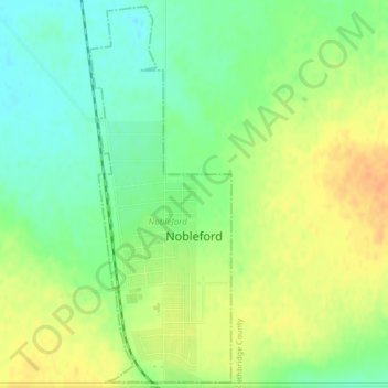
Nobleford topographic map
Interactive map
Click on the map to display elevation.
About this map
Name: Nobleford topographic map, elevation, terrain.
Location: Nobleford, Division No. 2, Alberta, T0L 1S0, Canada (49.87334 -113.06124 49.89952 -113.04597)
Average elevation: 986 m
Minimum elevation: 969 m
Maximum elevation: 1,003 m
Division No. 2 trails, hiking, mountain biking, running and outdoor activities
Other topographic maps
Click on a map to view its topography, its elevation and its terrain.