Geolocate

Stilesville topographic map

Click on the map to display elevation.

About this map

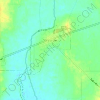
Name: Stilesville topographic map, elevation, terrain.

Location: Stilesville, Hendricks County, Indiana, United States (39.62900 -86.64039 39.64251 -86.62631)

Average elevation: 240 m

Minimum elevation: 231 m

Maximum elevation: 254 m

Other topographic maps

Click on a map to view its topography, its elevation and its terrain.

Tilden

United States > Indiana > Hendricks County

Average elevation: 272 m

Summit

United States > Indiana > Hendricks County

Average elevation: 264 m

Maplewood

United States > Indiana > Hendricks County

Average elevation: 287 m

Montclair

United States > Indiana > Hendricks County

Average elevation: 290 m

Pecksburg

United States > Indiana > Hendricks County

Average elevation: 256 m

Raintown

United States > Indiana > Hendricks County

Average elevation: 291 m

Reno

United States > Indiana > Hendricks County

Average elevation: 274 m

Springtown

United States > Indiana > Hendricks County

Average elevation: 262 m

Joppa

United States > Indiana > Hendricks County

Average elevation: 225 m

Hazelwood

United States > Indiana > Hendricks County

Average elevation: 245 m

Hadley

United States > Indiana > Hendricks County

Average elevation: 277 m

Gale

United States > Indiana > Hendricks County

Average elevation: 269 m

Friendswood

United States > Indiana > Hendricks County

Average elevation: 226 m

Center Valley

United States > Indiana > Hendricks County

Average elevation: 246 m

Cartersburg

United States > Indiana > Hendricks County

Average elevation: 242 m

Belleville

United States > Indiana > Hendricks County

Average elevation: 256 m

Gear up for your next adventure:

🛶Waterproof Dry Bags - Keep electronics and clothes dry during river crossings
🧣Merino Neck Gaiter - Protects against wind, sun, and cold at high altitudes
🔦UV Flashlight - Detect minerals or specific insects in the dark
🥾All-Terrain Hiking Boots - Versatile boots for varied hiking conditions
🔨Vehicle Emergency Tool - Safety tool for remote road trips to trailheads

As an Amazon Associate, this site earns from qualifying purchases at no extra cost to you.