Geolocate

Gale topographic map

Click on the map to display elevation.

About this map

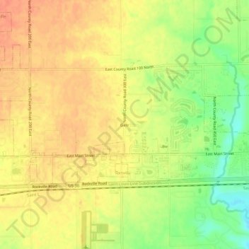
Name: Gale topographic map, elevation, terrain.

Location: Gale, Hendricks County, Indiana, 46122, United States (39.74671 -86.48666 39.78671 -86.44666)

Average elevation: 269 m

Minimum elevation: 240 m

Maximum elevation: 286 m

Other topographic maps

Click on a map to view its topography, its elevation and its terrain.

Lizton

United States > Indiana > Hendricks County

Average elevation: 292 m

North Salem

United States > Indiana > Hendricks County

Average elevation: 278 m

Stilesville

United States > Indiana > Hendricks County

Average elevation: 240 m

Coatesville

United States > Indiana > Hendricks County

Average elevation: 271 m

Pittsboro

United States > Indiana > Hendricks County

Average elevation: 285 m

Amo

United States > Indiana > Hendricks County

Average elevation: 255 m

Avon

United States > Indiana > Hendricks County

Average elevation: 254 m

Danville

United States > Indiana > Hendricks County

Average elevation: 281 m

Clayton

United States > Indiana > Hendricks County

Average elevation: 263 m

Gear up for your next adventure:

💧Collapsible Water Bottle - Space-saving water bottle for outdoor activities
🥾Hiking Shoes - Durable and comfortable shoes for trail hiking
🥘Camping Cookware Set - Compact nesting pots and pans for trail cooking
🔨Vehicle Emergency Tool - Safety tool for remote road trips to trailheads
🔋Lithium AA Batteries - Long-lasting power that performs in extreme cold

As an Amazon Associate, this site earns from qualifying purchases at no extra cost to you.