Geolocate

Center Valley topographic map

Click on the map to display elevation.

About this map

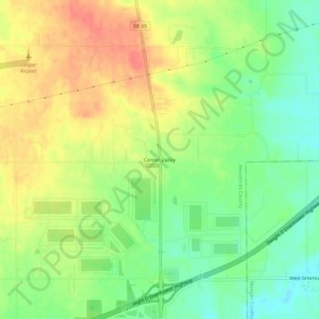
Name: Center Valley topographic map, elevation, terrain.

Location: Center Valley, Hendricks County, Indiana, United States (39.61032 -86.50000 39.65032 -86.46000)

Average elevation: 246 m

Minimum elevation: 220 m

Maximum elevation: 272 m

Other topographic maps

Click on a map to view its topography, its elevation and its terrain.

Danville

United States > Indiana > Hendricks County

Average elevation: 281 m

North Salem

United States > Indiana > Hendricks County

Average elevation: 278 m

Stilesville

United States > Indiana > Hendricks County

Average elevation: 240 m

Coatesville

United States > Indiana > Hendricks County

Average elevation: 271 m

Pittsboro

United States > Indiana > Hendricks County

Average elevation: 285 m

Amo

United States > Indiana > Hendricks County

Average elevation: 255 m

Avon

United States > Indiana > Hendricks County

Average elevation: 254 m

Clayton

United States > Indiana > Hendricks County

Average elevation: 263 m

Lizton

United States > Indiana > Hendricks County

Average elevation: 292 m

Gear up for your next adventure:

📷Outdoor Action Camera - Capture high-elevation views and rugged adventures
🚲Bike Repair Kit - Essential tools for on-trail mechanical issues
Camping Essentials - All-in-one gear for a comfortable camping trip
🧥Waterproof Jacket - Lightweight rain jackets for hiking and outdoor activities
🛏️Camping Sleeping Mat - Comfortable mats for sleeping outdoors

As an Amazon Associate, this site earns from qualifying purchases at no extra cost to you.