Geolocate

Dover topographic map

Click on the map to display elevation.

About this map

Name: Dover topographic map, elevation, terrain.

Location: Dover, Kent, England, CT16 1NB, United Kingdom (51.08513 1.27342 51.16513 1.35342)

Average elevation: 51 m

Minimum elevation: 0 m

Maximum elevation: 142 m

Other topographic maps

Click on a map to view its topography, its elevation and its terrain.

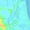
Tilmanstone

United Kingdom > England > Kent > Dover

Average elevation: 69 m

Sandwich

United Kingdom > England > Kent > Dover > Stone Cross

Average elevation: 5 m

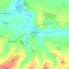
Eastry

United Kingdom > England > Kent > Dover > Eastry

Average elevation: 32 m

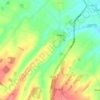
Nonington

United Kingdom > England > Kent > Dover

Average elevation: 68 m

Whitfield

United Kingdom > England > Kent > Dover

Average elevation: 101 m

Temple Ewell

United Kingdom > England > Kent > Dover

Average elevation: 96 m

Alkham

United Kingdom > England > Kent > Dover

Average elevation: 119 m

Wingham

United Kingdom > England > Kent > Dover

Average elevation: 22 m

Whitfield

United Kingdom > England > Kent > Dover > Whitfield

Average elevation: 101 m

River

United Kingdom > England > Kent > Dover

Average elevation: 80 m

Sandwich

United Kingdom > England > Kent > Dover

Average elevation: 5 m

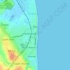
Deal

United Kingdom > England > Kent > Dover

Average elevation: 6 m

River

United Kingdom > England > Kent > Dover > River

Average elevation: 80 m

Gear up for your next adventure:

🥾Trail Hiking Shoes - Durable shoes designed for rugged trails
👟Trail Running Shoes - Agile footwear for fast-paced topographic exploration
🔭Compact Monocular - One-handed bird watching and trail spotting
💡Portable Camping Lamp - Rechargeable lamp for campsite lighting
🥾Mountain Hiking Shoes - Shoes with superior grip for mountainous terrain

As an Amazon Associate, this site earns from qualifying purchases at no extra cost to you.