Geolocate

River topographic map

Click on the map to display elevation.

About this map
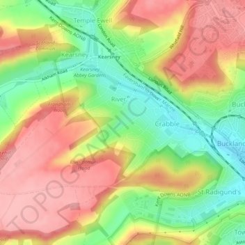
Name: River topographic map, elevation, terrain.

Location: River, Dover, Kent, England, United Kingdom (51.13301 1.25211 51.14895 1.28951)

Average elevation: 80 m

Minimum elevation: 15 m

Maximum elevation: 136 m

Other topographic maps

Click on a map to view its topography, its elevation and its terrain.

Betteshanger

United Kingdom > England > Kent > Dover > Northbourne

Average elevation: 38 m

Ewell Minnis

United Kingdom > England > Kent > Dover > Alkham

Average elevation: 110 m

Dover

United Kingdom > England > Kent > Dover

Average elevation: 51 m

Finglesham

United Kingdom > England > Kent > Dover > Northbourne

Average elevation: 16 m

Kingsdown

United Kingdom > England > Kent > Dover

Average elevation: 20 m

Dover

United Kingdom > England > Kent > Dover

Average elevation: 51 m

Dover

United Kingdom > England > Kent > Dover

Average elevation: 51 m

Ratling

United Kingdom > England > Kent > Dover > Aylesham

Average elevation: 55 m

Dover

United Kingdom > England > Kent > Dover

Average elevation: 51 m

Beech Grove Bruderhof

United Kingdom > England > Kent > Dover > Nonington

Average elevation: 54 m

Gear up for your next adventure:

👖Convertible Hiking Pants - Zip-off legs to adapt to changing weather conditions
🧴Insect Repellent - Protect yourself from bugs during outdoor adventures
🧦Hiking Liner Socks - Thin base layer to prevent friction and blisters
🧰Emergency Multi-Tool - Compact multi-tool for outdoor survival
🥾Approach Boots - Comfortable boots for hiking and climbing approaches

As an Amazon Associate, this site earns from qualifying purchases at no extra cost to you.