Geolocate

Tilmanstone topographic map

Click on the map to display elevation.

About this map
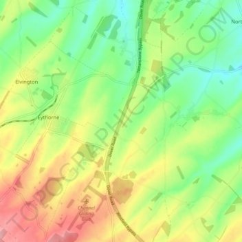
Name: Tilmanstone topographic map, elevation, terrain.

Location: Tilmanstone, Dover, Kent, England, United Kingdom (51.16984 1.26773 51.22541 1.30903)

Average elevation: 69 m

Minimum elevation: 21 m

Maximum elevation: 135 m

Other topographic maps

Click on a map to view its topography, its elevation and its terrain.

Dover

United Kingdom > England > Kent > Dover

Average elevation: 51 m

Betteshanger

United Kingdom > England > Kent > Dover > Northbourne

Average elevation: 38 m

Ewell Minnis

United Kingdom > England > Kent > Dover > Alkham

Average elevation: 110 m

Finglesham

United Kingdom > England > Kent > Dover > Northbourne

Average elevation: 16 m

Kingsdown

United Kingdom > England > Kent > Dover

Average elevation: 20 m

Dover

United Kingdom > England > Kent > Dover

Average elevation: 51 m

Dover

United Kingdom > England > Kent > Dover

Average elevation: 51 m

Ratling

United Kingdom > England > Kent > Dover > Aylesham

Average elevation: 55 m

Dover

United Kingdom > England > Kent > Dover

Average elevation: 51 m

Beech Grove Bruderhof

United Kingdom > England > Kent > Dover > Nonington

Average elevation: 54 m

Gear up for your next adventure:

🔋Emergency Crank Radio - Weather alerts and power without needing batteries
🚲Handlebar Phone Mount - View topographic-map.com live while cycling
❄️Traction Ice Cleats - Slip-on spikes for icy trails and winter hiking
🪑Ultralight Camping Stool - Compact seating for rest stops during long hikes
🧢Sun Hat - Wide-brim hat for sun protection

As an Amazon Associate, this site earns from qualifying purchases at no extra cost to you.