Geolocate

Temple Ewell topographic map

Click on the map to display elevation.

About this map

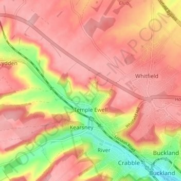
Name: Temple Ewell topographic map, elevation, terrain.

Location: Temple Ewell, Dover, Kent, South East England, England, United Kingdom (51.14563 1.22502 51.16693 1.28691)

Average elevation: 96 m

Minimum elevation: 15 m

Maximum elevation: 136 m

Gear up for your next adventure:

🩹Moleskin Blister Pads - Direct protection for painful foot pressure points
🧴Waterproofing Spray - Restore the DWR coating on jackets and tents
👟Sport Hiking Sandals - Breathable footwear for water crossings and camp rest
🔭Outdoor Binoculars - Lightweight binoculars for birdwatching and hiking
🔦LED Flashlight - Powerful and long-lasting flashlight for camping and emergencies

As an Amazon Associate, this site earns from qualifying purchases at no extra cost to you.