Geolocate

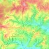
East End topographic map

Click on the map to display elevation.

About this map

Name: East End topographic map, elevation, terrain.

Location: East End, Tunbridge Wells, Kent, England, TN17 4AX, United Kingdom (51.06636 0.60039 51.10636 0.64039)

Average elevation: 59 m

Minimum elevation: 11 m

Maximum elevation: 93 m

Other topographic maps

Click on a map to view its topography, its elevation and its terrain.
Frittenden

United Kingdom > England > Kent > Tunbridge Wells

Average elevation: 34 m

Hawkhurst

United Kingdom > England > Kent > Tunbridge Wells

Average elevation: 67 m

Paddock Wood

United Kingdom > England > Kent > Tunbridge Wells

Average elevation: 33 m

Goudhurst

United Kingdom > England > Kent > Tunbridge Wells > Goudhurst

Average elevation: 76 m

Benenden

United Kingdom > England > Kent > Tunbridge Wells

Average elevation: 61 m

Pembury

United Kingdom > England > Kent > Tunbridge Wells

Average elevation: 99 m

Bidborough

United Kingdom > England > Kent > Tunbridge Wells

Average elevation: 71 m

Horsmonden

United Kingdom > England > Kent > Tunbridge Wells > Horsmonden

Average elevation: 51 m

Speldhurst

United Kingdom > England > Kent > Tunbridge Wells

Average elevation: 89 m

Rusthall

United Kingdom > England > Kent > Tunbridge Wells > Rusthall

Average elevation: 100 m

Capel

United Kingdom > England > Kent > Tunbridge Wells

Average elevation: 47 m

Hurst Wood

United Kingdom > England > Kent > Tunbridge Wells > Rusthall

Average elevation: 101 m

Speldhurst

United Kingdom > England > Kent > Tunbridge Wells

Average elevation: 89 m

Benenden

United Kingdom > England > Kent > Tunbridge Wells > Benenden

Average elevation: 61 m

Hawkhurst

United Kingdom > England > Kent > Tunbridge Wells

Average elevation: 67 m

Benenden

United Kingdom > England > Kent > Tunbridge Wells

Average elevation: 61 m

Goudhurst

United Kingdom > England > Kent > Tunbridge Wells

Average elevation: 76 m

Paddock Wood

United Kingdom > England > Kent > Tunbridge Wells > Whetsted

Average elevation: 33 m

Capel

United Kingdom > England > Kent > Tunbridge Wells

Average elevation: 47 m

Gear up for your next adventure:

🧦Crew Hiking Socks - Comfortable socks for long-distance hikes
🪜Heavy Duty Carabiners - Multi-use clips for securing gear to your backpack
🔭Compact Binoculars - Lightweight optics for scouting trails and wildlife
🧢Outdoor Cap - Protective cap for sun and rain during hikes
🥾Hiking Shoes - Durable and comfortable shoes for trail hiking

As an Amazon Associate, this site earns from qualifying purchases at no extra cost to you.