Geolocate

Benenden topographic map

Click on the map to display elevation.

About this map
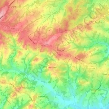
Name: Benenden topographic map, elevation, terrain.

Location: Benenden, Tunbridge Wells, Kent, England, United Kingdom (51.03761 0.53072 51.09144 0.64664)

Average elevation: 61 m

Minimum elevation: 1 m

Maximum elevation: 126 m

Gear up for your next adventure:

⛺Camping Groundsheet - Protect your tent from moisture and dirt
🚲Heavy Duty Bike Lock - Secure your bike at the trailhead or during stops
🧣Evaporative Cooling Towel - Beat the heat during intense summer climbs
🎒Hiking Daypack - Lightweight and durable backpacks for day trips and excursions
🥾Trail Running Shoes - Lightweight and durable shoes for trail running

As an Amazon Associate, this site earns from qualifying purchases at no extra cost to you.