Geolocate

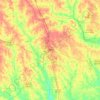
Lowndes County topographic map

Click on the map to display elevation.

About this map

Name: Lowndes County topographic map, elevation, terrain.

Location: Lowndes County, Georgia, United States (30.62397 -83.48493 31.03191 -83.02021)

Average elevation: 52 m

Minimum elevation: 21 m

Maximum elevation: 83 m

Other topographic maps

Click on a map to view its topography, its elevation and its terrain.
Dublin

United States > Georgia > Laurens County > Dublin

Average elevation: 68 m

Brasstown Bald

United States > Georgia > Towns County

Average elevation: 1,161 m

Atlanta

United States > Georgia > Fulton County

Atlanta occupies a high, rolling part of the Georgia Piedmont, a physiographic region described as a landscape of low hills and narrow valleys between the Blue Ridge Mountains and the Upper Coastal Plain. Around downtown and Fulton County, the terrain is gently dissected rather than flat, with broad urban…

Average elevation: 285 m
Crowe Lake

United States > Georgia > Gwinnett County

Average elevation: 349 m

High Hill Lake

United States > Georgia > Glynn County

Average elevation: 7 m

Griffin Lake

United States > Georgia > Brooks County

Average elevation: 60 m

Tifton

United States > Georgia > Tift County > Tifton > Tifton

Average elevation: 96 m

Cherokee Hills

United States > Georgia > Coffee County

Average elevation: 70 m

Fort Pulaski

United States > Georgia > Chatham County

Average elevation: 1 m

Harris Lake

United States > Georgia > Tattnall County

Average elevation: 62 m

Rowland Lake

United States > Georgia > Jones County

Average elevation: 175 m
Keith

United States > Georgia > Catoosa County > Keith

Average elevation: 267 m

Ponder Park

United States > Georgia > Tift County > Omega

Average elevation: 96 m

Ridley Lake

United States > Georgia > Troup County > LaGrange

Average elevation: 225 m

Shellnut

United States > Georgia > Heard County > Shellnut

Average elevation: 235 m

Johns Creek

United States > Georgia > Fulton County > Johns Creek

Average elevation: 305 m

Gear up for your next adventure:

🚲Handlebar Phone Mount - View topographic-map.com live while cycling
🧥Ultralight Puffy Jacket - Maximum warmth that packs down to the size of an orange
🔦UV Flashlight - Detect minerals or specific insects in the dark
🥾Hiking Boots - Sturdy boots providing ankle support and traction on rugged trails
⛺Backpacking Tent - Lightweight tent for long-distance hiking trips

As an Amazon Associate, this site earns from qualifying purchases at no extra cost to you.