Geolocate

Keith topographic map

Click on the map to display elevation.

About this map

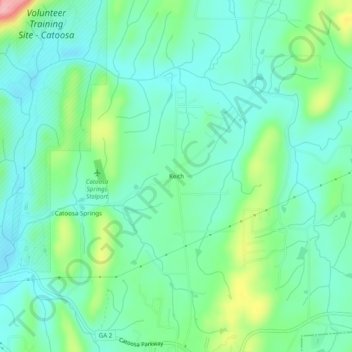
Name: Keith topographic map, elevation, terrain.

Location: Keith, Catoosa County, Georgia, United States (34.89813 -85.06189 34.93813 -85.02189)

Average elevation: 267 m

Minimum elevation: 231 m

Maximum elevation: 370 m

Gear up for your next adventure:

🧴Insect Repellent - Protect yourself from bugs during outdoor adventures
💡Solar Camping Lamp - Eco-friendly lighting for campsites
🥾Waterproof Trail Shoes - Shoes designed to handle wet terrain
🧢Sun Hat - Wide-brim hat for sun protection
🥾All-Terrain Hiking Boots - Versatile boots for varied hiking conditions

As an Amazon Associate, this site earns from qualifying purchases at no extra cost to you.