
Crowe Lake topographic map
Click on the map to display elevation.
About this map
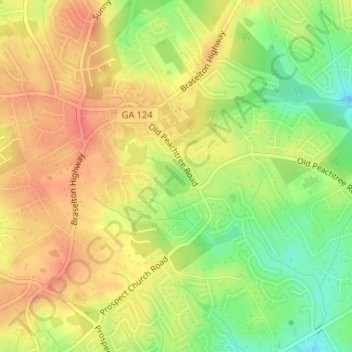
Name: Crowe Lake topographic map, elevation, terrain.
Location: Crowe Lake, Gwinnett County, Georgia, United States (34.02950 -83.95368 34.03239 -83.94995)
Average elevation: 349 m
Minimum elevation: 317 m
Maximum elevation: 371 m
Other topographic maps
Click on a map to view its topography, its elevation and its terrain.
Snellville
United States > Georgia > Gwinnett County
Compared to most large cities around the world at approximately the same latitude (33°39'), such as Beirut, Casablanca, Dallas, Los Angeles, and Phoenix, Snellville has lower average winter temperatures. The primary reason for this is that the North American continent extends into high latitudes that allows…
Average elevation: 300 m