
Bururi topographic map
Interactive map
Click on the map to display elevation.
About this map
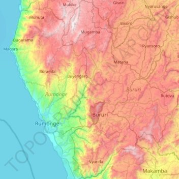
Name: Bururi topographic map, elevation, terrain.
Location: Bururi, Burundi (-4.16237 29.48871 -3.55737 29.91658)
Average elevation: 1,563 m
Minimum elevation: 763 m
Maximum elevation: 2,678 m
Other topographic maps
Click on a map to view its topography, its elevation and its terrain.