
Kayokwe topographic map
Interactive map
Click on the map to display elevation.
About this map
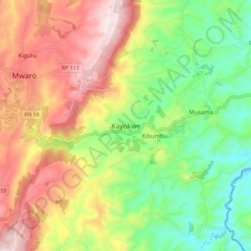
Name: Kayokwe topographic map, elevation, terrain.
Location: Kayokwe, Mwaro, Burundi (-3.56764 29.69747 -3.48764 29.77747)
Average elevation: 1,828 m
Minimum elevation: 1,614 m
Maximum elevation: 2,083 m