
Ruvubu topographic map
Interactive map
Click on the map to display elevation.
About this map
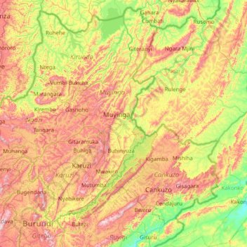
Name: Ruvubu topographic map, elevation, terrain.
Location: Ruvubu, Burundi (-3.39297 29.55170 -2.38945 30.78696)
Average elevation: 1,508 m
Minimum elevation: 1,179 m
Maximum elevation: 2,047 m
Other topographic maps
Click on a map to view its topography, its elevation and its terrain.