
Ngozi topographic map
Interactive map
Click on the map to display elevation.
About this map
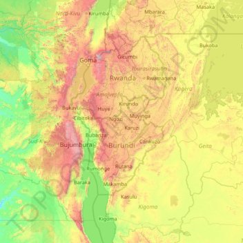
Name: Ngozi topographic map, elevation, terrain.
Location: Ngozi, Burundi (-5.48207 27.34224 -0.28207 32.54224)
Average elevation: 1,258 m
Minimum elevation: 543 m
Maximum elevation: 4,148 m
Other topographic maps
Click on a map to view its topography, its elevation and its terrain.