Geolocate

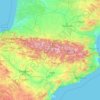
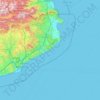
Iberian Peninsula topographic map

Click on the map to display elevation.

Iberian Peninsula

The Iberian Peninsula encompasses 583,254 km2 and has very contrasting and uneven topograph. The mountain ranges of the Iberian Peninsula are mainly distributed from west to east, and in some cases reach altitudes of approximately 3,000 mamsl, resulting in the region having the second highest mean altitude (637 mamsl) in Western Europe.

Wikipedia (CC-BY-SA 3.0)

About this map

Name: Iberian Peninsula topographic map, elevation, terrain.

Location: Iberian Peninsula, Spain (36.00004 -9.50059 43.79042 3.32225)

Average elevation: 351 m

Minimum elevation: -3 m

Maximum elevation: 3,211 m

Other topographic maps

Click on a map to view its topography, its elevation and its terrain.

Cambarco

Spain > Cantabria > Cabezón de Liébana

Average elevation: 686 m

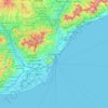
Barcelona

Spain > Catalonia > Barcelonès > Barcelona

Average elevation: 65 m

Perrozo

Spain > Cantabria > Cabezón de Liébana

Average elevation: 685 m

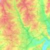
Madrid

Spain > Community of Madrid > Madrid

Average elevation: 650 m

Luriezo

Spain > Cantabria > Cabezón de Liébana

Average elevation: 910 m

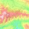
Sierra Nevada

Spain > Andalusia > Comarca de Guadix

Average elevation: 1,310 m

Frama

Spain > Cantabria > Cabezón de Liébana

Average elevation: 537 m

Orellana

Spain > Andalusia > Utrera

Average elevation: 65 m

Villager de Laciana

Spain > Castile and León > Villablino

Average elevation: 1,191 m

Salarzón

Spain > Cantabria > Cillorigo de Liébana

Salarzón is a locality of Cillorigo de Liébana municipality, in the Liébana region of Cantabria, Spain. It is located at 666 meters altitude and it is 6,8 kilometres far from Tama, the municipal capital. It has 33 inhabitants (INE, 2008). This neighborhood belongs to "Bedoya's Council", formed by several…

Average elevation: 746 m

Argüébanes

Spain > Cantabria > Camaleño

Average elevation: 647 m

Obargo

Spain > Cantabria > Pesaguero

Average elevation: 811 m

Cahecho

Spain > Cantabria > Cabezón de Liébana

Average elevation: 792 m

Toledo

Spain > Castile-La Mancha > Toledo > Toledo

Average elevation: 590 m

Yebas

Spain > Cantabria > Cabezón de Liébana

Average elevation: 832 m

Almadrava

Spain > Valencian Community > els Poblets

Average elevation: 6 m

El Cercado

Spain > Canary Islands > Vallehermoso

Average elevation: 998 m

Vendejo

Spain > Cantabria > Pesaguero

Average elevation: 1,006 m

La Vega

Spain > Cantabria > Vega de Liébana

Average elevation: 715 m

Adeje

Spain > Canary Islands > Adeje

Average elevation: 495 m

El Corraón

Spain > Asturias > Lena

Average elevation: 505 m

Úrcal

Spain > Andalusia > Huércal-Overa

Average elevation: 487 m

Maredes

Spain > Cantabria > Vega de Liébana

Average elevation: 790 m

Yebas

Spain > Castile and León > Bozoó

Average elevation: 959 m

Candanchú

Spain > Aragon > Jacetania > Aísa

Average elevation: 1,686 m

Pyrenees

Spain

The Pyrenees (/ˈpɪrɪniːz/; Spanish: Pirineos [piɾiˈneos]; French: Pyrénées [piʁene] (listen); Catalan: Pirineu [piɾiˈnɛw]; Basque: Pirinioak [piɾini.o.ak]; Occitan: Pirenèus [piɾeˈnɛws]; Aragonese: Pirineus) is a mountain range straddling the border of France and Spain. It extends nearly 500…

Average elevation: 491 m
Bular

Spain > Navarre > Baztan-Bidasoa > Baztan

Average elevation: 536 m

Valdeprado

Spain > Cantabria > Pesaguero

Average elevation: 1,009 m

Puente Pumar

Spain > Cantabria > Lombraña

Average elevation: 994 m

Polientes

Spain > Cantabria > Valderredible

Average elevation: 770 m

Piedracea

Spain > Asturias > Lena

Average elevation: 598 m

Pyrenees

Spain

The Pyrenees is a mountain range in southwestern Europe, straddling the France–Spain border. The Pyrenees extend nearly 500 kilometres (310 mi) from their union with the Cantabrian Mountains to Cap de Creus on the Mediterranean coast, reaching a maximum elevation of 3,404 metres (11,168 ft) at the peak of…

Average elevation: 570 m

Brez

Spain > Cantabria > Camaleño

Average elevation: 771 m

Griebal

Spain > Aragon > Sobrarbe

Average elevation: 665 m

Pyrenees

Spain

The Pyrenees (/ˈpɪrɪniːz/; Spanish: Pirineos [piɾiˈneos]; French: Pyrénées [piʁene] (listen); Catalan: Pirineu [piɾiˈnɛw]; Basque: Pirinioak [piɾini.o.ak]; Occitan: Pirenèus [piɾeˈnɛws]; Aragonese: Pirineus) is a mountain range straddling the border of France and Spain. It extends nearly 500…

Average elevation: 491 m

Menorca

Spain > Balearic Islands > Es Migjorn Gran

Average elevation: 9 m

Alhambra

Spain > Andalusia > Comarca de la Vega de Granada > Granada

During the reign of the Nasrid Dynasty, the Alhambra was transformed into a palatine city, complete with an irrigation system composed of aqueducts and water channels that provided water for the complex and for other nearby countryside palaces such as the Generalife. Previously, the old fortresses on the hill…

Average elevation: 759 m
Tanarrio

Spain > Cantabria > Camaleño

Average elevation: 810 m

La Espasa

Spain > Asturias > Caravia

Average elevation: 54 m

Picos de Europa

Spain > Asturias > Cabrales

The Picos de Europa ("Peaks of Europe", also the Picos) are a mountain range extending for about 20 km (12 mi), forming part of the Cantabrian Mountains in northern Spain. The range is situated in the Autonomous Communities of Asturias, Cantabria and Castile and León. The highest peak is Torre de Cerredo, at…

Average elevation: 2,290 m
Vigo

Spain > Galicia > Vigo

Vigo has a transitional climate between the oceanic climate "Cfb" and the warm-summer Mediterranean climate "Csb" according to the Köppen climate classification. Although Vigo is the rainiest city in Galicia, with its noticeable drying trend in the summer, Vigo's climate is more similar to the variant of the…

Average elevation: 121 m

Esculca

Spain > Castile and León > Ibeas de Juarros

Average elevation: 1,130 m

Carmena

Spain > Castile-La Mancha > Carmena

Average elevation: 559 m

Caleta de Fuste

Spain > Canary Islands > Antigua

Average elevation: 26 m

El Farrobo

Spain > Canary Islands > La Guancha > La Guancha

Average elevation: 586 m

Serra d'Aitana

Spain > Valencian Community > la Marina Baixa > Benifato

The most spectacular part of the trail is the Font de Partagás - Pas de la rabossa - Summit of Aitana with a distance of 2 km. It starts at 1040 meters elevation, with almost 500 meters of uneven terrain. The path is well signposted with trail markings and distance signs.

Average elevation: 836 m

Masada d'en Gassol

Spain > Catalonia > Baix Ebre > Tortosa

Average elevation: 59 m

Llena del Aspe

Spain > Aragon > Jacetania > Ansó

Average elevation: 2,190 m

Tías

Spain > Canary Islands > Tías

Average elevation: 170 m

Malh de Hèr

Spain > Catalonia > Val d'Aran

Average elevation: 2,065 m

Picamoixons

Spain > Catalonia > Alt Camp > Valls

Average elevation: 284 m

Rícmar

Spain > Andalusia > Costa del Sol Occidental > Marbella

Average elevation: 35 m

Tías

Spain > Canary Islands > Tías

Average elevation: 170 m

Loureiro

Spain > Galicia > Morrazo > Bueu

Average elevation: 84 m

Fontanar de Quintos

Spain > Andalusia > Córdoba > La Golondrina

Average elevation: 96 m

Ordejón de Abajo

Spain > Castile and León > Humada

Average elevation: 1,007 m

Tías

Spain > Canary Islands > Tías

Average elevation: 170 m

Salselles

Spain > Catalonia > Berguedà > Borredà

Average elevation: 760 m

Merlín

Spain > Galicia > O Deza

Average elevation: 541 m

Llongarriu

Spain > Catalonia > Garrotxa > la Vall de Bianya

Average elevation: 698 m

Santiago de Compostela

Spain > Galicia > Santiago

The cathedral borders the main plaza of the old and well-preserved city. According to medieval legend, the remains of the apostle James were brought to Galicia for burial; in 813, the light of a bright star guided a shepherd who was watching his flock at night to the burial site in Santiago de Compostela. This…

Average elevation: 248 m
Bercedo

Spain > Castile and León > Merindad de Montija

Average elevation: 803 m

Los Vegas

Spain > Andalusia > Valle del Almanzora > Serón

Average elevation: 922 m

Picos de Europa

Spain > Asturias > Cabrales

The Picos de Europa ("Peaks of Europe", also the Picos) are a mountain range extending for about 20 km (12 mi), forming part of the Cantabrian Mountains in northern Spain. The range is situated in the Autonomous Communities of Asturias, Cantabria and Castile and León. The highest peak is Torre de Cerredo, at…

Average elevation: 2,290 m

SIERRA DE JAVALAMBRE

Spain > Aragon > Gúdar-Javalambre > Abejuela

Average elevation: 1,446 m

Costa Brava

Spain

Average elevation: 247 m

Los Pinganillos

Spain > Andalusia > Fuente Obejuna

Average elevation: 603 m

Marismas de Alday

Spain > Cantabria > Camargo > Maliaño

Average elevation: 10 m

San Miguel de Montefurado

Spain > Galicia > Quiroga

Average elevation: 421 m

Park Guell

Spain > Catalonia > Barcelonès > Barcelona

Average elevation: 133 m

Lamaboa

Spain > Galicia > A Mariña Occidental > Xove

Average elevation: 123 m

Mogrovejo

Spain > Cantabria > Camaleño

Average elevation: 783 m

Aidí

Spain > Catalonia > Pallars Sobirà > Llavorsí

Average elevation: 1,200 m

Miraverde

Spain > Canary Islands > Adeje

Average elevation: 140 m

Torreta

Spain > Navarre > Erdialdea > Tafalla > Tafalla

Average elevation: 425 m

Crons

Spain > Galicia > Noia

Average elevation: 164 m

Urrá

Spain > Andalusia > Sorbas

Average elevation: 377 m

La Esperanza

Spain > Canary Islands > El Rosario

Average elevation: 868 m

Terveu

Spain > Catalonia > Pallars Sobirà > Tírvia

Average elevation: 1,109 m

Gear up for your next adventure:

🧥Softshell Jacket - Windproof and breathable jacket for hiking
🥾Mountain Hiking Shoes - Shoes with superior grip for mountainous terrain
🥫Freeze-Dried Meals - Lightweight, high-calorie nutrition for multi-day treks
🎒Backpack Rain Cover - External shield to keep your entire pack dry
🥾Hiking Leggings - Comfortable leggings for outdoor activities

As an Amazon Associate, this site earns from qualifying purchases at no extra cost to you.