Geolocate

Frama topographic map

Click on the map to display elevation.

About this map
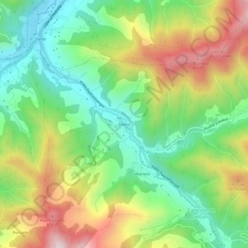
Name: Frama topographic map, elevation, terrain.

Location: Frama, Cabezón de Liébana, Cantabria, 39574, Spain (43.12715 -4.61266 43.16715 -4.57266)

Average elevation: 537 m

Minimum elevation: 262 m

Maximum elevation: 949 m

Gear up for your next adventure:

🥾Waterproof Hiking Boots - Boots keeping your feet dry in wet conditions
🛰️Satellite Messenger - Emergency communication for areas with no cell service
🚑Survival Whistle - Signal for help across long distances in mountains
🛏️Sleeping Bag - Warm and compact sleeping bags for outdoor camping
🥾Lightweight Hiking Boots - Boots for comfort and mobility on long hikes

As an Amazon Associate, this site earns from qualifying purchases at no extra cost to you.