Geolocate

El Corraón topographic map

Click on the map to display elevation.

About this map
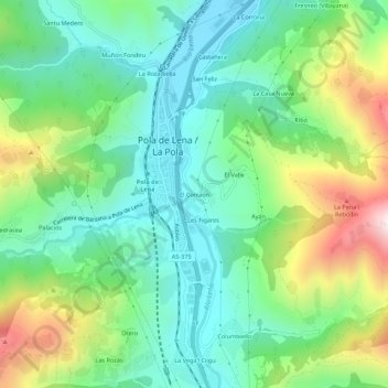
Name: El Corraón topographic map, elevation, terrain.

Location: El Corraón, La Pola, Lena, Asturias, 33630, Spain (43.13653 -5.84439 43.17653 -5.80439)

Average elevation: 505 m

Minimum elevation: 275 m

Maximum elevation: 1,012 m

Other topographic maps

Click on a map to view its topography, its elevation and its terrain.

Chanos de Somerón

Spain > Asturias > Lena

Average elevation: 985 m

Congostinas

Spain > Asturias > Lena

Average elevation: 1,009 m

Zurea

Spain > Asturias > Lena

Average elevation: 811 m

Gear up for your next adventure:

🔋Emergency Crank Radio - Weather alerts and power without needing batteries
⛺Camping Groundsheet - Protect your tent from moisture and dirt
🦶Anti-Blister Balm - Prevents friction and hotspots during long ascents
⛺Tent Footprint - Protect tent floor and increase durability
🕶️Polarized Sunglasses - Protect your eyes with durable polarized lenses

As an Amazon Associate, this site earns from qualifying purchases at no extra cost to you.