Geolocate

Tudes topographic map

Click on the map to display elevation.

About this map
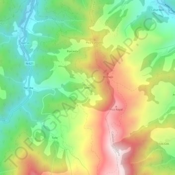
Name: Tudes topographic map, elevation, terrain.

Location: Tudes, Vega de Liébana, Cantabria, 39575, Spain (43.10138 -4.63078 43.14138 -4.59078)

Average elevation: 685 m

Minimum elevation: 319 m

Maximum elevation: 1,192 m

Gear up for your next adventure:

🥾Trekking Poles - Adjustable trekking poles to reduce knee stress and improve stability
📷Outdoor Action Camera - Capture high-elevation views and rugged adventures
🥾Light Trekking Boots - Supportive boots for multi-day treks
👖Convertible Hiking Pants - Zip-off legs to adapt to changing weather conditions
🧤Insulated Winter Gloves - Heavy-duty protection for sub-zero Canadian adventures

As an Amazon Associate, this site earns from qualifying purchases at no extra cost to you.