Geolocate

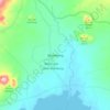
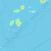
Patikul topographic map

Click on the map to display elevation.

About this map

Name: Patikul topographic map, elevation, terrain.

Location: Patikul, Sulu, Zamboanga Peninsula, Philippines (6.03110 120.99668 6.21196 121.23585)

Average elevation: 50 m

Minimum elevation: -6 m

Maximum elevation: 758 m

Other topographic maps

Click on a map to view its topography, its elevation and its terrain.

Omar

Philippines > Sulu

Average elevation: 39 m

Maimbung

Philippines > Sulu

Average elevation: 76 m

Jolo

Philippines > Sulu

Average elevation: 57 m

Bambannan Island

Philippines > Sulu

Average elevation: 0 m

Capual

Philippines > Sulu

Average elevation: 81 m

Talipao

Philippines > Sulu

Average elevation: 138 m

Luuk

Philippines > Sulu

Average elevation: 22 m

Old Panamao

Philippines > Sulu

Average elevation: 41 m

Parang

Philippines > Sulu

Average elevation: 47 m

North Ubian Island

Philippines > Sulu > Pangutaran

Average elevation: 2 m

Seit Lake

Philippines > Sulu > Old Panamao

Average elevation: 14 m

Bangkilay

Philippines > Sulu > Pangutaran

Average elevation: 6 m

Mount Tayungan

Philippines > Sulu > Masjid Bayli

Average elevation: 158 m

Tunggol

Philippines > Sulu

Average elevation: 45 m

Old Panamao

Philippines > Sulu

Average elevation: 41 m

Jolo

Philippines > Sulu

Average elevation: 57 m

Samal Island

Philippines > Sulu > Siasi

Average elevation: 3 m

Old Panamao

Philippines > Sulu

Average elevation: 41 m

Gear up for your next adventure:

🌡️Emergency Mylar Blankets - Compact thermal protection for unexpected nights outdoors
🥾Waterproof Hiking Shoes - Durable shoes for wet and rugged trails
🥫Freeze-Dried Meals - Lightweight, high-calorie nutrition for multi-day treks
🎒Hiking Daypack - Lightweight and durable backpacks for day trips and excursions
🧦Outdoor Socks - Durable socks designed for hiking and outdoor sports

As an Amazon Associate, this site earns from qualifying purchases at no extra cost to you.