Geolocate

Bangkilay topographic map

Click on the map to display elevation.

About this map

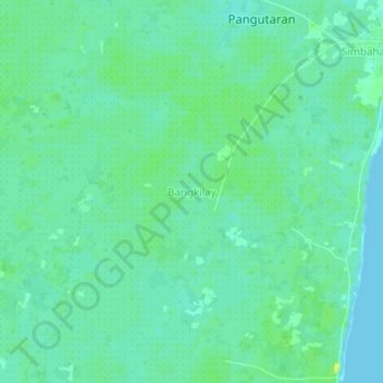
Name: Bangkilay topographic map, elevation, terrain.

Location: Bangkilay, Pangutaran, Sulu, Zamboanga Peninsula, Philippines (6.26606 120.54446 6.30606 120.58446)

Average elevation: 6 m

Minimum elevation: 0 m

Maximum elevation: 15 m

Other topographic maps

Click on a map to view its topography, its elevation and its terrain.

North Ubian Island

Philippines > Sulu > Pangutaran

Average elevation: 2 m

Kulassian Island

Philippines > Sulu > Pangutaran

Average elevation: 0 m

Gear up for your next adventure:

🧥Thermal Fleece Jacket - Versatile insulation for changing mountain temperatures
🧦Thermal Socks - Warm socks for winter hiking or camping
🚲Bike Repair Kit - Essential tools for on-trail mechanical issues
👟Trail Running Shoes - Agile footwear for fast-paced topographic exploration
🛏️Camping Sleeping Mat - Comfortable mats for sleeping outdoors

As an Amazon Associate, this site earns from qualifying purchases at no extra cost to you.