Geolocate

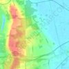
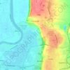
Ealand topographic map

Click on the map to display elevation.

About this map
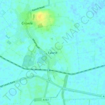
Name: Ealand topographic map, elevation, terrain.

Location: Ealand, North Lincolnshire, England, DN17 4JD, United Kingdom (53.57656 -0.83629 53.61656 -0.79629)

Average elevation: 4 m

Minimum elevation: -1 m

Maximum elevation: 20 m

Other topographic maps

Click on a map to view its topography, its elevation and its terrain.
Wootton

United Kingdom > England > North Lincolnshire

Average elevation: 45 m

Bonby

United Kingdom > England > North Lincolnshire

Average elevation: 34 m

Broughton

United Kingdom > England > North Lincolnshire

Average elevation: 24 m

Brigg

United Kingdom > England > North Lincolnshire

Average elevation: 6 m

Winterton

United Kingdom > England > North Lincolnshire

Average elevation: 19 m

Horkstow

United Kingdom > England > North Lincolnshire

Average elevation: 37 m

Belton

United Kingdom > England > North Lincolnshire

Average elevation: 4 m

Wroot

United Kingdom > England > North Lincolnshire

Average elevation: 2 m

Appleby

United Kingdom > England > North Lincolnshire

Average elevation: 19 m

Gunness

United Kingdom > England > North Lincolnshire

Average elevation: 3 m

Worlaby

United Kingdom > England > North Lincolnshire

Average elevation: 37 m

Haxey

United Kingdom > England > North Lincolnshire

The civil parish includes the town of Haxey and the village of Westwoodside, and the hamlets of Haxey Carr, High Burnham (the highest elevation of the Isle of Axholme), Low Burnham, East Lound, Graizelound and Upperthorpe which is conjoined to Westwoodside.

Average elevation: 7 m
Brigg

United Kingdom > England > North Lincolnshire

Average elevation: 6 m

Winterton

United Kingdom > England > North Lincolnshire

Average elevation: 19 m

Epworth

United Kingdom > England > North Lincolnshire

Average elevation: 6 m

Winterton

United Kingdom > England > North Lincolnshire

Average elevation: 19 m

Gear up for your next adventure:

🥾Trail Hiking Socks - Comfortable socks to prevent blisters and fatigue
🛌Insulated Sleeping Pad - Critical thermal barrier between you and the cold ground
💧Reusable Water Bottle - Durable water bottles for hydration on trails
🥾Hiking Shorts - Breathable shorts suitable for summer hikes
🔋Emergency Crank Radio - Weather alerts and power without needing batteries

As an Amazon Associate, this site earns from qualifying purchases at no extra cost to you.