Geolocate

East Butterwick topographic map

Click on the map to display elevation.

About this map

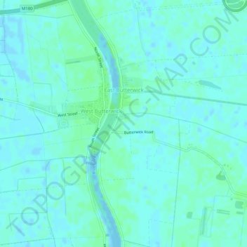
Name: East Butterwick topographic map, elevation, terrain.

Location: East Butterwick, North Lincolnshire, England, United Kingdom (53.52634 -0.74356 53.55632 -0.70621)

Average elevation: 3 m

Minimum elevation: -4 m

Maximum elevation: 7 m

Other topographic maps

Click on a map to view its topography, its elevation and its terrain.

Cleatham

United Kingdom > England > North Lincolnshire

Average elevation: 36 m

Ealand

United Kingdom > England > North Lincolnshire

Average elevation: 4 m

Crowle

United Kingdom > England > North Lincolnshire

Average elevation: 3 m

Bracon

United Kingdom > England > North Lincolnshire

Average elevation: 7 m

Keadby

United Kingdom > England > North Lincolnshire

Average elevation: 3 m

Beltoft

United Kingdom > England > North Lincolnshire

Average elevation: 5 m

Gear up for your next adventure:

🧦Hiking Socks - Moisture-wicking and comfortable socks for long hikes
🛌Down Sleeping Bag - Superior warmth-to-weight ratio for cold nights
🧦Crew Hiking Socks - Comfortable socks for long-distance hikes
🔋Solar Power Bank - Keep your GPS and devices charged during long outdoor trips
🥾Light Hiking Boots - Lightweight and comfortable boots for day hikes

As an Amazon Associate, this site earns from qualifying purchases at no extra cost to you.