Geolocate

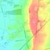
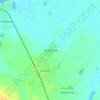
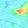
Burton upon Stather topographic map

Click on the map to display elevation.

About this map

Name: Burton upon Stather topographic map, elevation, terrain.

Location: Burton upon Stather, North Lincolnshire, Greater Lincolnshire, England, United Kingdom (53.62899 -0.71339 53.65933 -0.62767)

Average elevation: 29 m

Minimum elevation: -2 m

Maximum elevation: 77 m

Other topographic maps

Click on a map to view its topography, its elevation and its terrain.
Cleatham

United Kingdom > England > North Lincolnshire

Average elevation: 36 m

Ealand

United Kingdom > England > North Lincolnshire

Average elevation: 4 m

Crowle

United Kingdom > England > North Lincolnshire

Average elevation: 3 m

Bracon

United Kingdom > England > North Lincolnshire

Average elevation: 7 m

Keadby

United Kingdom > England > North Lincolnshire

Average elevation: 3 m

Beltoft

United Kingdom > England > North Lincolnshire

Average elevation: 5 m

Roxby

United Kingdom > England > North Lincolnshire

Average elevation: 32 m

Keadby

United Kingdom > England > North Lincolnshire

Average elevation: 3 m

Crowle

United Kingdom > England > North Lincolnshire

Average elevation: 3 m

Gear up for your next adventure:

🌬️Windproof Camp Stove - Efficient cooking even on exposed mountain peaks
🎒Hiking Daypack - Lightweight and durable backpacks for day trips and excursions
🧣Evaporative Cooling Towel - Beat the heat during intense summer climbs
🧶550 Survival Paracord - Versatile utility cord for emergency repairs and rigging
🥾Hiking Boots - Sturdy boots providing ankle support and traction on rugged trails

As an Amazon Associate, this site earns from qualifying purchases at no extra cost to you.