Geolocate

Martin County topographic map

Click on the map to display elevation.

About this map

Name: Martin County topographic map, elevation, terrain.

Location: Martin County, Indiana, United States (38.49459 -86.92434 38.90470 -86.68234)

Average elevation: 180 m

Minimum elevation: 129 m

Maximum elevation: 283 m

Other topographic maps

Click on a map to view its topography, its elevation and its terrain.
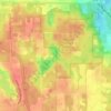
Crooked Lake

United States > Indiana > Steuben County

Average elevation: 307 m

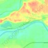
Aaron

United States > Indiana > Switzerland County

Average elevation: 272 m

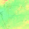
Snacks

United States > Indiana > Marion County > Indianapolis

Average elevation: 244 m

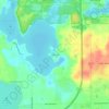
Vertland

United States > Indiana > Marion County > Indianapolis

Average elevation: 250 m

Sullivan

United States > Indiana > Sullivan County > Sullivan > Sullivan

Average elevation: 153 m

Nutwood

United States > Indiana > Saint Joseph County

Average elevation: 259 m

Oriole Lake

United States > Indiana > Perry County

Average elevation: 211 m

Carlson Lake

United States > Indiana > Porter County > Valparaiso

Average elevation: 250 m

North Grove

United States > Indiana > Miami County

Average elevation: 250 m

Danes

United States > Indiana > Cass County

Average elevation: 203 m

Slough Creek

United States > Indiana > Jasper County

Average elevation: 206 m

Glen Eden

United States > Indiana > Steuben County > Glen Eden

Average elevation: 310 m

Gary

United States > Indiana > Lake County > Gary

Average elevation: 187 m

Gear up for your next adventure:

🧥Waterproof Jacket - Lightweight rain jackets for hiking and outdoor activities
🪑Ultralight Camping Stool - Compact seating for rest stops during long hikes
🥾Waterproof Hiking Boots - Essential footwear for rugged terrain and wet Canadian trails
Family Camping Tent - Spacious tent suitable for family camping trips
🧼Biodegradable Camp Soap - Environmentally friendly cleaning for gear and body

As an Amazon Associate, this site earns from qualifying purchases at no extra cost to you.