
Patan topographic map
Interactive map
Click on the map to display elevation.
About this map
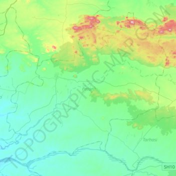
Name: Patan topographic map, elevation, terrain.
Location: Patan, Palamu District, Jharkhand, 822123, Inde (24.07922 84.07657 24.29094 84.34582)
Average elevation: 285 m
Minimum elevation: 200 m
Maximum elevation: 598 m
Other topographic maps
Click on a map to view its topography, its elevation and its terrain.
Rāmnagartola
Rāmnagartola, Pakaur, Pakur District, Jharkhand, 816107, Inde
Average elevation: 34 m
Sahibganj (block)
Sahibganj (block), Sahibganj District, Jharkhand, 816109, Inde
Average elevation: 60 m