

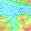
Greiz topographic map
Click on the map to display elevation.
About this map

Name: Greiz topographic map, elevation, terrain.
Location: Greiz, Thuringia, Germany (50.54925 11.85883 50.97599 12.32221)
Average elevation: 347 m
Minimum elevation: 173 m
Maximum elevation: 553 m
Other topographic maps
Click on a map to view its topography, its elevation and its terrain.
Wartburg
Germany > Thuringia > Wartburgkreis > Eisenach
The Wartburg (German pronunciation: [ˈvaʁtbʊʁk]) is a castle originally built in the Middle Ages. At an elevation of 410 metres (1,350 ft) in the state of Thuringia, Germany, it is situated on a southwest-facing precipice and overlooks the town of Eisenach to the north. It was the home of St. Elisabeth of…
Average elevation: 284 m


Wohnsiedlung Am Flugplatz
Germany > Thuringia > Unstrut-Hainich-Kreis > Obermehler
Average elevation: 269 m


Jena
Jena is situated in a hilly landscape in eastern Thuringia at the Saale river, between the Harz mountains 85 km (53 mi) in the north, the Thuringian Forest/Thuringian Highland 50 km (31 mi) in the southwest and the Ore Mountains, 75 km (47 mi) in the southeast. The municipal terrain is hilly with rugged slopes…
Average elevation: 289 m






Rotterode
Germany > Thuringia > Landkreis Schmalkalden-Meiningen > Steinbach-Hallenberg
Average elevation: 570 m







Unterburg
Germany > Thuringia > Kyffhäuserkreis > Kyffhäuserland > Kohlstätte
Average elevation: 301 m
