Geolocate

Frießnitz topographic map

Click on the map to display elevation.

About this map

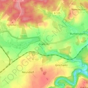
Name: Frießnitz topographic map, elevation, terrain.

Location: Frießnitz, Harth-Pöllnitz, Greiz, Thuringia, 07570, Germany (50.76000 11.97002 50.80000 12.01002)

Average elevation: 328 m

Minimum elevation: 277 m

Maximum elevation: 374 m

Other topographic maps

Click on a map to view its topography, its elevation and its terrain.

Weida

Germany > Thuringia > Greiz

Average elevation: 315 m

Großenstein

Germany > Thuringia > Greiz

Average elevation: 287 m

Greiz

Germany > Thuringia > Greiz

Average elevation: 380 m

Gear up for your next adventure:

🧦Outdoor Socks - Durable socks designed for hiking and outdoor sports
🧼Travel Hand Sanitizer - Keep hands clean when water is scarce
🛏️Camping Sleeping Mat - Comfortable mats for sleeping outdoors
💡LED Camping Lantern - Illuminate your campsite with long-lasting lanterns
🧢Sun Protection Cap - Breathable cap to protect from sun exposure

As an Amazon Associate, this site earns from qualifying purchases at no extra cost to you.