Geolocate

Aledo topographic map

Click on the map to display elevation.

About this map

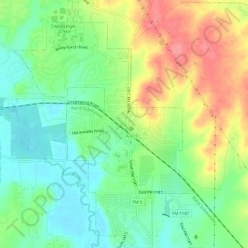
Name: Aledo topographic map, elevation, terrain.

Location: Aledo, Parker County, Texas, United States (32.67678 -97.62642 32.71900 -97.58975)

Average elevation: 271 m

Minimum elevation: 238 m

Maximum elevation: 317 m

Gear up for your next adventure:

🗺️Topographic Maps - Detailed maps to explore trails, mountains, and wilderness areas
🔋Lithium AA Batteries - Long-lasting power that performs in extreme cold
🐕Hiking Dog Pack - Let your canine companion carry their own water and food
🚲Handlebar Phone Mount - View topographic-map.com live while cycling
🥾Waterproof Hiking Boots - Boots keeping your feet dry in wet conditions

As an Amazon Associate, this site earns from qualifying purchases at no extra cost to you.