Geolocate

Whitt topographic map

Click on the map to display elevation.

About this map

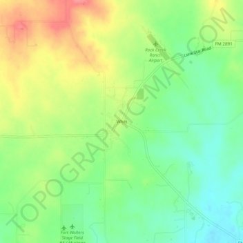
Name: Whitt topographic map, elevation, terrain.

Location: Whitt, Parker County, Texas, 76490, United States (32.93623 -98.03893 32.97623 -97.99893)

Average elevation: 339 m

Minimum elevation: 306 m

Maximum elevation: 382 m

Other topographic maps

Click on a map to view its topography, its elevation and its terrain.

Weatherford

United States > Texas > Parker County

Average elevation: 326 m

Reno

United States > Texas > Parker County

Average elevation: 233 m

Aledo

United States > Texas > Parker County

Average elevation: 271 m

Springtown

United States > Texas > Parker County

Average elevation: 273 m

Millsap

United States > Texas > Parker County

Average elevation: 257 m

Snake Forest

United States > Texas > Parker County

Average elevation: 312 m

Aledo

United States > Texas > Parker County

Average elevation: 271 m

Weatherford

United States > Texas > Parker County

Average elevation: 326 m

Gear up for your next adventure:

🧣Merino Neck Gaiter - Protects against wind, sun, and cold at high altitudes
🗺️Topographic Maps - Detailed maps to explore trails, mountains, and wilderness areas
🔥Emergency Fire Starter - Reliable ignition source for all weather conditions
🥾Trekking Boots - Durable boots for long-distance trekking
🧊Insulated Water Bottle - Keeps drinks cold in summer and prevents freezing in winter

As an Amazon Associate, this site earns from qualifying purchases at no extra cost to you.