Geolocate

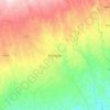
Kerio topographic map

Click on the map to display elevation.

About this map

Name: Kerio topographic map, elevation, terrain.

Location: Kerio, Rift Valley, Kenya (0.37747 35.59653 2.99001 36.27799)

Average elevation: 1,217 m

Minimum elevation: 275 m

Maximum elevation: 4,228 m

Other topographic maps

Click on a map to view its topography, its elevation and its terrain.
Busia

Kenya > Busia County > Teso South

Busia, Kenya is located in Busia County, approximately 451 kilometres (280 mi), by road, northwest of Nairobi, Kenya's capital and largest city. This location is immediately east of Busia, Uganda. The coordinates of Busia, Kenya are: 00°27'48.0"N, 34°06'19.0"E (Latitude:0.463333; Longitude:34.105278). Busia,…

Average elevation: 1,201 m
Yatta Plateau

Kenya > Kitui County > Kitui South

Average elevation: 621 m

Maragua

Kenya > Murang'a County > Murang`a South

Average elevation: 1,355 m

Mlolongo

Kenya > Machakos > Mlolongo

Average elevation: 1,591 m

Kisumu

Kenya > Kisumu > Kisumu

The name Kisumu literally means a place of barter trade "sumo". The city has "Friendship" status with Cheltenham, United Kingdom and "sister city" status with Roanoke, Virginia and Boulder, Colorado, United States. Its elevation is 1,131 m (3,711 ft) above sea level. Kisumu is about 320 km (200 mi) northwest…

Average elevation: 1,155 m
Kenya

Kenya > Nakuru > Nakuru East > Nakuru East ward

Average elevation: 1,831 m

Timboroa

Kenya > Baringo

Average elevation: 2,697 m

Kutus

Kenya > Kirinyaga County

Average elevation: 1,285 m

Mathira

Kenya > Laikipia County > Laikipia West

Average elevation: 1,799 m

Usenge

Kenya > Siaya County

Average elevation: 1,147 m

Malindi

Kenya > Kilifi County > Malindi

Average elevation: 15 m

Wild Fire

Kenya > Nakuru > Naivasha > Hells Gate ward > Junction 1

Average elevation: 1,952 m

Nairobi

Kenya > Nairobi County > Nairobi

Average elevation: 1,724 m

Machakos

Kenya > Machakos County

Average elevation: 1,666 m

Maragwa

Kenya > Nyamira County > Nyamira North > Magwagwa ward

Average elevation: 1,675 m

Bura West

Kenya > Tana River County

Average elevation: 104 m

Kerugoya

Kenya > Kirinyaga County > Kirinyaga Central

Average elevation: 1,552 m

Kaptagat

Kenya > Elgeyo-Marakwet County

Average elevation: 2,425 m

Gear up for your next adventure:

⛺Tent Footprint - Protect tent floor and increase durability
🛶Waterproof Dry Bags - Keep electronics and clothes dry during river crossings
🥾Trekking Poles - Adjustable trekking poles to reduce knee stress and improve stability
🐕Hiking Dog Pack - Let your canine companion carry their own water and food
🧴Waterproofing Spray - Restore the DWR coating on jackets and tents

As an Amazon Associate, this site earns from qualifying purchases at no extra cost to you.